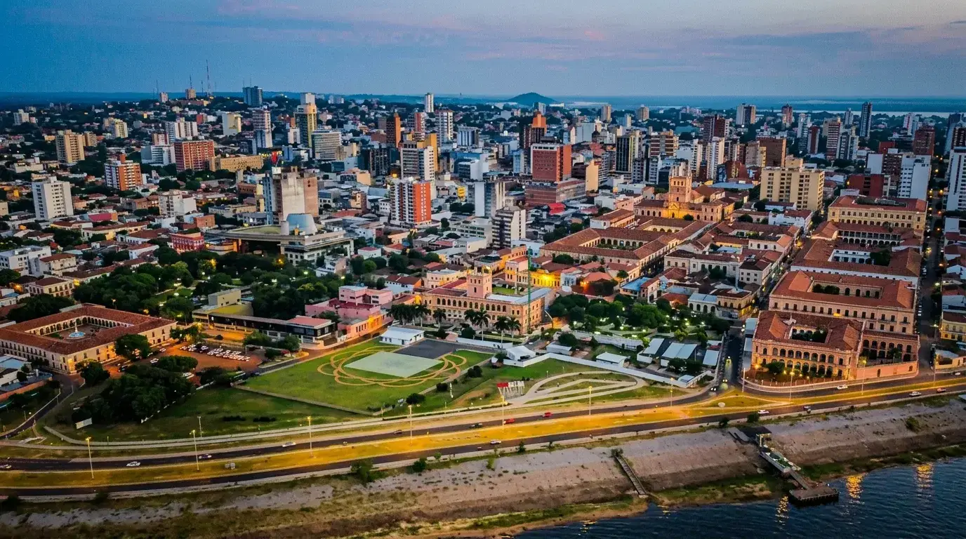

Paraguay divides into four clearly distinct tourist regions, each with its own climate, history and pace. The North is the arid Chaco, Mennonite communities and the far reaches of the Chaco War. The East is the Atlantic forest, little-known waterfalls and the industrial power of Itaipú. The Center is the urban and cultural heart around Asunción, Lake Ypacaraí and the art towns of the Cordillera. The South holds the UNESCO-listed Jesuit missions and the banks of the Paraná River up to the Yacyretá dam. This page gives an overview organized by region: it is aimed at travelers planning their first itinerary who want to understand the country's geography before choosing their stops, as well as returning visitors refining a second trip.
The 4 regions at a glance
Tourism in Paraguay resembles that of no other South American country: little dedicated infrastructure, a lot of authenticity, and a hospitality most travelers mention first in their accounts. Distances remain reasonable by continental standards (500 km north to south, 400 km east to west), but roads vary enormously from one region to another: paved highway in the Center, red dirt tracks in the Chaco. Allow time for travel and don't try to see everything in one week: the country is best discovered region by region, not in a single sweep.
| Quick comparison of the 4 regions | |||
|---|---|---|---|
| North | Arid Chaco, Mennonite colonies, wildlife | 3-7 days | May-September |
| East | Atlantic forest, waterfalls, Itaipú, tri-border area | 2-4 days | Year-round |
| Center | Capital, museums, lake, art towns | 3-5 days | Year-round |
| South | UNESCO Jesuit missions, Paraná River, fishing | 2-4 days | March-November |
North: the Chaco and the far reaches
The Paraguayan Chaco covers nearly 60% of the national territory for barely 3% of the population: it is the country's true vast expanse, a semi-arid plain stretching to Bolivia. The region is best explored around Filadelfia, Loma Plata and Neuland, three colonies founded by Mennonite immigrants in the 1930s, where Plautdietsch German is still heard daily alongside Spanish and Guaraní. Further east, Concepción retains colonial charm on the banks of the Paraguay River, and Pedro Juan Caballero marks the border with Brazil, next to Ponta Porã. Cerro Corá, in the northeast, is the site where the War of the Triple Alliance ended in 1870: a national park steeped in history, with rock outcrops that stand out against the surrounding plain.
The Chaco is best explored by 4x4, on tracks that become impassable after heavy rain. It is a region for wildlife spotting (armadillos, rheas, elusive pumas, abundant birdlife) more than monuments, and requires a minimum of planning: long distances, sparse gas stations, extreme summer heat (up to 45°C). For a first trip to Paraguay, the Chaco is not essential; for a second visit or an adventure-minded traveler, it is the country's most distinctive region.
East: waterfalls, Itaipú and the Atlantic forest
The East concentrates most of the country's economic weight and the last large blocks of Atlantic forest in South America. Ciudad del Este, the country's second city, is known for intense cross-border trade with Brazil and Argentina (the famous "triple frontier"), but also as the starting point for visiting the Itaipú dam, the world's second-largest hydroelectric plant by installed capacity, which can be toured for free. About thirty kilometers from Iguazú Falls on the Brazilian and Argentine side, Salto Cristal offers an equally spectacular but nearly deserted waterfall, a contrast many travelers point out.
Further north, the Mbaracayú biosphere reserve protects one of the continent's last continuous blocks of Atlantic forest, with ecotourism and volunteering programs run by the Fundación Moisés Bertoni. This region combines well with a stop at Iguazú Falls on the Argentine or Brazilian side, less than an hour's drive from Ciudad del Este, making it a logical stage for travelers combining several Southern Cone countries.
Center: Asunción and the Cordillera
The Center is home to nearly one in two Paraguayans and is the natural entry point for most trips. Asunción, the capital, mixes crumbling and beautifully restored colonial buildings, popular markets (the Mercado 4), and a cultural scene that has grown considerably over the past decade (Museo del Barro, revitalized neighborhoods along the Costanera). Around the capital, the Cordillera de los Altos gathers art and craft towns: Areguá, known for its stone houses and strawberries, San Bernardino, a former German resort on the shores of Lake Ypacaraí, and Piribebuy, more rural and authentic.
Lake Ypacaraí itself remains more of a scenic landmark than a swimming spot (legacy pollution, currently being treated), but its shores concentrate restaurants, craft markets and a very Paraguayan weekend atmosphere. This is the region where it's easiest to combine several activities in the same day, thanks to short distances and a transport offer (urban buses, Uber) more developed than elsewhere in the country.
South: Jesuit missions and the banks of the Paraná
The South of the country carries the most visible imprint of the 17th- and 18th-century Jesuit-Guaraní reductions. The ruins of La Santísima Trinidad de Paraná and Jesús de Tavarangue, listed as UNESCO World Heritage sites, rank among the best-preserved sites of this missionary experience in the Americas. Encarnación, the regional capital, has reinvented itself with genuine urban beaches on the artificial banks of the Paraná, created when the binational Yacyretá dam (shared with Argentina) was filled, and hosts one of the country's largest carnivals every year.
Further west, Pilar and the wetlands of Ñeembucú offer a more rural, amphibious side of the country, favored by sport fishermen (dorado, surubí catfish) and birdwatchers. The region is easily crossed by car or bus from Asunción (4 to 5 hours to Encarnación) and combines naturally with a crossing into Argentina toward the San Ignacio Miní missions, less than an hour away.
How to choose your region and plan your itinerary
Common itinerary combinations
- •First trip (10-14 days): Center (4 d) → South, Jesuit missions (3 d) → East, Itaipú and Iguazú (3 d)
- •Short stay (5-7 days): Center only, radiating from Asunción into the Cordillera
- •Nature trip (10+ days): Center (2 d) → East, Mbaracayú (3 d) → North, Chaco (5 d)
- •Regional combo: Southern Paraguay + Iguazú on the Argentine/Brazilian side + Buenos Aires or São Paulo
In practice, the Center serves as an almost mandatory logistical base: it is home to Silvio Pettirossi International Airport and the highest density of transport links. From Asunción, the South and East are reached in 4 to 5 hours by comfortable bus, while the Chaco requires a dedicated vehicle and a minimum of three days to be explored properly. Travelers short on time favor the Center and South; those returning for a second trip naturally turn to the East and North, less visited and logistically more demanding. Each region has its own detailed page, with cities, natural sites and practical information (transport, lodging, ideal season): use the links below or the interactive map on the homepage to build your route.
Climate-wise, the four regions are not equal either. The Center and South enjoy a milder subtropical climate thanks to their proximity to the Paraná River and slightly higher elevation, with moderate temperature swings year-round. The East, wetter, receives more evenly distributed rainfall due to the remaining Atlantic forest, which explains its denser vegetation and generous waterfalls even in the dry season. The North, by contrast, experiences the country's most extreme climate: crushing heat and marked drought in the austral summer, cool nights and cracked soil in winter. This climatic diversity, unusual for a territory this size, largely explains why each region deserves its own approach and visiting calendar rather than a generic itinerary applied uniformly across the whole country.
Last updated:
Sources
- SENATUR, Paraguay Tourism Portal
- UNESCO, Jesuit Missions of La Santísima Trinidad de Paraná and Jesús de Tavarangue (2024)
- Itaipú Binacional, dam tours (2025)
- MADES, Ministry of Environment and Sustainable Development - National parks
- Wikipedia, Paraguayan Chaco
- Wikipedia, Ciudad del Este
- Encyclopædia Britannica, Paraguay - Geography (2024)
- Visit Paraguay, official regional guide
- Bienvenido a Paraguay, Tourist Guide
- DNIT, National Directorate of Transport - road network
My method
This page is written from France, sourced as carefully as possible, but I can be wrong or miss on-the-ground detail. A price that changed, outdated info, a photo to share? Every correction is credited if you want.
Report an error or send info →Share