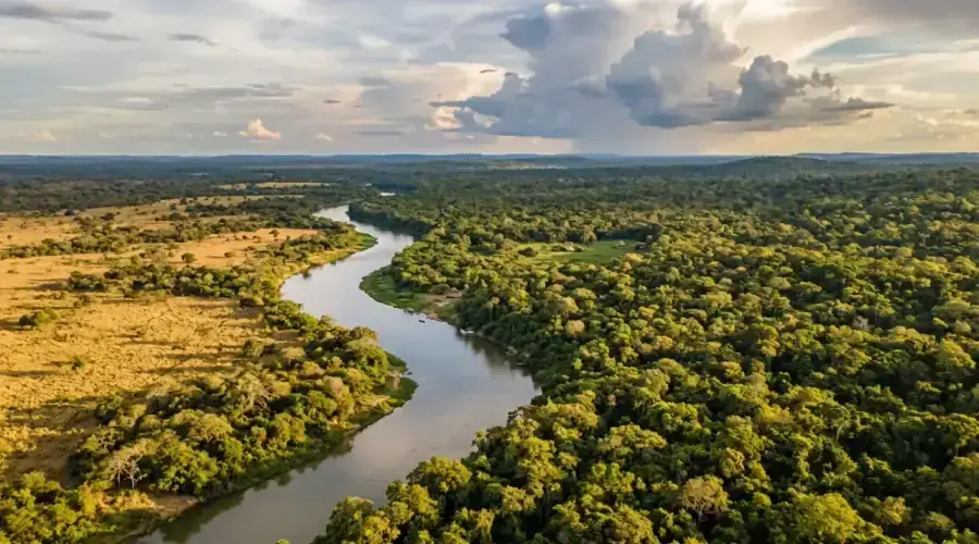
Paraguay is a country of sharp, almost graphic contrasts. One river divides it into two great halves, an eastern half dense and fertile, a western half vast, dry and almost empty. This contrast explains its identity. To the east, the land is greener, more inhabited, more agricultural. To the west, the Chaco extends its flat, burning, silent horizons. Between them, the Paraguay River is the country's backbone, an axis of life, transport and memory.
A country split in two
The Paraguay River divides the country as clearly as an internal border. To the east lies the Paranaense region, where the vast majority of the population lives, with gentle hills, red soils and a strong urban and agricultural concentration. To the west stretches the Chaco, an immense dry plain, sparsely populated and mineral.
This contrast gives the country two very different worlds. One is fertile, inhabited, connected to the great flows of the Southern Cone. The other is immense, harsh and almost desert-like.
- 1The East concentrates cities, intensive agriculture and most infrastructure
- 2The West covers much of the territory, but with very low population density
- 3The Paraguay River is the country's natural backbone
- 4The red soils of the East give the landscape an immediately recognizable color
The climate in four seasons
Paraguay's climate is humid subtropical, but varies strongly by region. Summer is intense, sometimes oppressive, with heavy heat and frequent storms at the end of the day. Winter is generally mild, but can surprise with cold air incursions that remind you the country is exposed to the continent's great climatic movements.
Spring and autumn are the most pleasant seasons for travel. Temperatures are milder, the light clearer, travel simpler. It is also the best time to discover the Jesuit missions, historic cities or natural landscapes without suffering the extremes of summer.
- 1Summer is hot and humid in the east, very harsh in the Chaco. 38-45C
- 2Winter is mild (15-20C), but can have brief cold snaps
- 3Spring and autumn are the best times to visit
- 4Rainfall is more abundant in the east (1,200-1,800 mm/year) than in the west (500-800 mm/year)
Rivers, dams and electricity
Paraguay is a country of rivers as much as roads. The Paraguay and Parana rivers play a decisive role in its history, economy and daily geography. They serve as natural corridors for trade, travel and energy production.
The Itaipu dam (14 GW, 90 TWh/year), shared with Brazil, is one of the great symbols of this relationship between water and power. More than just an engineering work, it redefined the national economy and the country's relationship with electricity. Yacyreta (3.1 GW) completes this system on the Argentine border. Together, they supply 100% of the country's electricity, and the surplus is sold. Paraguay is the world's largest electricity exporter per capita.
Five worlds in one country
Paraguay brings together several very distinct ecoregions, making it a surprisingly diverse territory. The dry Chaco is almost arid, with tough vegetation adapted to heat and lack of water. The humid Chaco, closer to flood zones, offers changing and unstable landscapes.
To the east, the Atlantic forest BAAPA has almost disappeared, but still represents one of the country's biological strongholds. Further northeast appear wooded savanna zones (Cerrado), while the Paraguayan Pantanal opens another world: that of marshes, birds, exceptional fauna.
- 1Dry Chaco: extreme heat, cacti, quebracho trees, bare horizons
- 2Humid Chaco: flood zones, gallery forests, grasslands
- 3BAAPA: Atlantic forest, precious remnant of a much vaster massif
- 4Cerrado: wooded savanna of the northeast
- 5Paraguayan Pantanal: major wetland, refuge for spectacular fauna
Paraguay shelters both one of the driest landscapes on the continent and one of its largest wetlands. A 45C difference between Chaco summer and the coolness of a winter night in the east.
Cities, relief and today's challenges
Asuncion remains the great political and urban center of the country, but it does not exhaust its human geography. Ciudad del Este plays a major role in border trade, Encarnacion opens the country to its river beaches and historic sites, while Filadelfia embodies the other Paraguay, that of the Mennonite Chaco.
Paraguay's relief is not spectacular in the Andean sense, but it is structuring. The hills of the east, the plains of the west and the permanent presence of water organize daily life much more than one might think. The country is not built around peaks, but around balances.
Climate and land use are evolving rapidly under the effect of climate change, urban pressure and agricultural practices. Chaco droughts, urban heat in Asuncion and water level variations of the great rivers are becoming increasingly visible challenges.
- 1Cities are highly polarized around a few hubs
- 2The economy largely follows the geography of water and soils
- 3Climate vulnerabilities are stronger than imagined
- 4The country is already a space of ecological and agricultural transition
Why Paraguayan geography fascinates
Because it combines in a single country extreme contrasts: humidity and drought, city and emptiness, energy and isolation, intensive agriculture and almost wild zones. Paraguay is a country cut by a river, structured by water, and defined by the contrast between the inhabited East and the immense West.
Last updated:
Sources
- World Bank - Climate Change Knowledge Portal: Paraguay
- CIA World Factbook - Paraguay (2024) (2024)
- UNESCO - Paraguayan Pantanal tentative listing
- DMH - Directorate of Meteorology and Hydrology
- Itaipu Binacional - Environmental impact
- WWF - Gran Chaco ecoregion
- NASA Earth Observatory - Paraguay
- FAO Aquastat - Paraguay water resources
My method
This page is written from France, sourced as carefully as possible, but I can be wrong or miss on-the-ground detail. A price that changed, outdated info, a photo to share? Every correction is credited if you want.
Report an error or send info →Share